
फाइल:Locatie Middellandse Zee.PNG
इ पूर्वावलोकन कय आकार: ८०० × ४८९ पिक्सेल । अउर resolutions: ३२० × १९५ पिक्सेल | ६४० × ३९१ पिक्सेल | ९०२ × ५५१ पिक्सेल।
मूल फ़ाइल (९०२ × ५५१ पिक्सेल, फाइल आकार: ३३ केबी, MIME प्रकार: image/png)
| जानकारी |
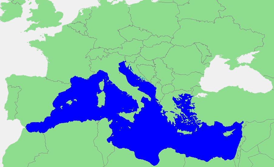
Nederlands: Locatie Middellandse Zee
中文:地中海地图 |
||||
| स्रोत | own work based on PD map | ||||
| लेखक | edited by M.Minderhoud | ||||
| अनुमति (इस फ़ाइल की पुनः उपयोग) |
|
फाइल कय इतिहास
मिति/समय मे क्लिक कइकै फाइल उ समय कैसन बिलगात रहा देखा जाय
| तारीख/समय | अंगूठाकार प्रारूप | आकार | सदस्य | टिप्पणी | |
|---|---|---|---|---|---|
| अबहिनै कय | २३:५१, १२ सितम्बर २००६ | | ९०२ × ५५१ (३३ केबी) | Michiel1972 | {{Information |Description=In dutch: {{subst:PAGENAME}} |Source= own work based on PD map |Date= |Author= edited by M.Minderhoud |Permission= {{PD-Demis}} |other_versions= }} category:Locator maps of seas |
फ़ाइल कय उपयोग
निचे दिहा पन्ना में इ फ़ाइल कय कड़ि हैं:
वैश्विक फाइल प्रयोग
अउर विकि जवन इ फाइल कय प्रयोग करत हँय:
- ang.wikipedia.org पर उपयोग
- an.wikipedia.org पर उपयोग
- avk.wikipedia.org पर उपयोग
- bat-smg.wikipedia.org पर उपयोग
- be-tarask.wikipedia.org पर उपयोग
- bm.wikipedia.org पर उपयोग
- ca.wikipedia.org पर उपयोग
- cbk-zam.wikipedia.org पर उपयोग
- cdo.wikipedia.org पर उपयोग
- ceb.wikipedia.org पर उपयोग
- crh.wikipedia.org पर उपयोग
- csb.wikipedia.org पर उपयोग
- de.wikipedia.org पर उपयोग
- el.wikipedia.org पर उपयोग
- en.wikipedia.org पर उपयोग
- eo.wikipedia.org पर उपयोग
- es.wikipedia.org पर उपयोग
- et.wikipedia.org पर उपयोग
- fa.wikipedia.org पर उपयोग
- fiu-vro.wikipedia.org पर उपयोग
- fr.wikipedia.org पर उपयोग
इ फ़ाइल कय वैश्विक उपयोग कय अधिक जानकारी देखा जाय।